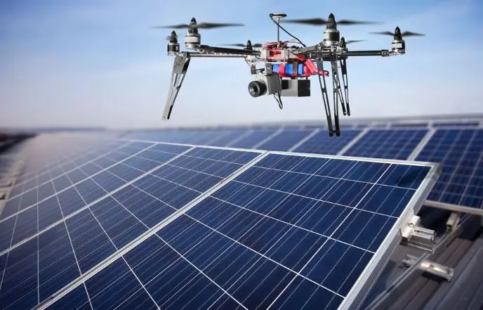
[metaslider id=”2863″]At the edge of muddy Wisconsin farmland, down the road from Stout University, a college engineering student lets go of a white two-foot, loudly humming drone. Grass blows flat on take-off, the flying robotic flies steady and strong. Within seconds, the drone – which weighs less than 2lbs and carries a powerful camera – ascends hundreds of feet into the warm, clear, blue summer sky as the young man begins to capture detailed photos of his Grandfather’s land far below.
The humming drone is guided toward a very long pole barn, perfect for rows of large solar panels. Twenty minutes of birds-eye footage is downloaded and shared almost instantly. Views in the past seen only by helicopter. VR (virtual reality) meets IRL (in real life). This is the exciting age we live in.
Synching the soaring popularity of drone technology with solar energy, one of the fastest growing sources of new electricity generation capacity in the country is not only timely, it has vision.
It is reported that newly certified U.S. commercial drone operators since late August 2016 were at 37,000 and counting. And newly installed U.S. solar capacity in all of 2016 at 14.8 GW. More people are benefiting from solar today than at any point in the past.
Considering drone technology’s ability to offer non-invasive data capture, reduce site time, cut costs and increase safety for workers, it’s easy to see the partnership between drones and solar as reported by Solar Industry Magazine.
For renewable energy, cost is key. To compete with non-renewable energy sources solar energy companies and developers are reducing their costs by increasing their tech investment into drone technology. Drones facilitate highly advanced imaging and data collection, offering opportunities for less expensive project site analysis, design, construction, maintenance and operation of solar electrical systems noted in The Guardian.
Prior to drones the survey of a project site could only be done by dispatching a crew to gather information such as site terrain, obstructions, tree cover, vegetation and the steepness of a slope. Terrain features can have a significant impact on solar PV system productivity, and can be either beneficial or detrimental for project performance. For this reason, it is very important to evaluate site conditions during the design phase. Traditional measuring and mapping costs labor and time. By electronically mapping locations for potential builds, drones can obtain data down to the nearest millimeter and use a web-connected camera. This detailed analysis aids solar companies and developers fully understand the property and use the land as efficiently as possible.
There is a growing number of drone imaging software that aid solar system project design. Drone imaging software options include Pix4D, PhotoScan, 3DF Sephyr and Reality Capture. These futuristic programs offer from 3D mapping and modeling from reality, photogrammetry (the technique to extract geometric information from two-dimensional images or video), point clouds that share data with collaborators, orthomosaics (an aerial photograph geometrically corrected such that the scale is uniform and the photo has the same lack of distortion as the map) and computer vision. Just as “gamers” do, design teams work remotely together, based on almost perfect data.
During the solar project build, construction drones can be the “eyes” of project managers on-site, saving hours of time and related cost of transportation. Project visits in person can become much less frequent. If a project manager wants to “visit” the project it is as simple as logging in remotely to one of the drones in the project, and piloting it around the project with a remote control interface.
During a solar PV installation, drones are also used to record progress. Clients track construction by viewing drone provided aerial photos of their project. And Drone footage also serves a unique opportunity for streaming solar – gaining public awareness of solar PV designs and the magnitude of solar in general.
Once the solar array is up and running, the maintenance and operation of PV systems are enhanced with drone overhead visual images as well as thermal imaging for larger solar panel system inspection.
If that wasn’t enough – drones can charge on SOLAR ENERGY…TOTAL VICTORY!!!


